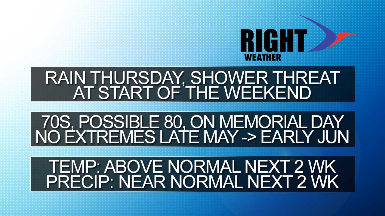
Long-Range Forecast – May 22

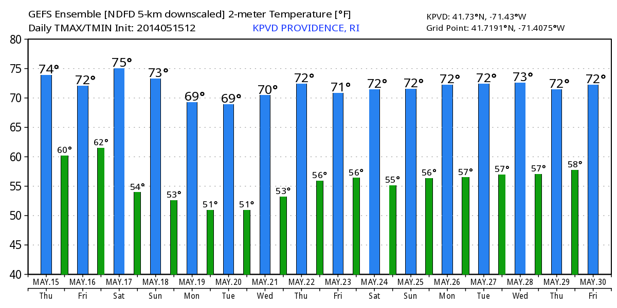
Believe it or not, the longest consecutive stretch of 70°+ days in Providence this year is three from May 10-12 when the temperature actually averaged over 80°. Aside from that brief run of warm weather, there have only been two other times with back to back 70°+ days. Needless to say, there are plenty of Southern New Englanders yearning for a warm stretch of weather. After all, the normal high temperature is 70° at this time of the year.

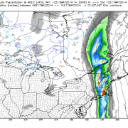
That warm stretch of weather will not happen over the Memorial Day weekend. In fact, it looks a little cool and unsettled Friday to Sunday. Highs will generally be in the 60s, with the threat of showers. The best chance of rain Saturday and Sunday is in the afternoon and early evening. Memorial Day should be mostly sunny and seasonably warm, with highs in the 70s. A cold front will move through on Tuesday possibly bringing a few showers.

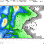
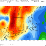
The weather looks pleasant from Wednesday into late next week and the start of June. There may be a warming trend that gets the temperature back close to 80 inland by next weekend. As mentioned in the video, there is some uncertainty about the precipitation forecast, particularly in days 8-14. Right now, it looks mainly dry over the next couple of weeks with the best threat of showers in the next few days, and then again in the first few days of June.

Late Workweek Weather Trending Drier

Thursday is looking a lot less like a wet day in eastern New England, and, it’s actually trending toward mostly dry in RI and SE MA. The 12km NAM is completely dry in RI on Thursday. The higher resolution 4km NAM has some showers in the morning, but only for a couple of hours. It’s a little weather in Northeast MA and Southern NH in both models, with a showery morning likely in those places.

The GFS and ECMWF are also trending drier. The bottom line is while showers cannot be ruled out, it does not look anything like a washout on Thursday or Friday.

Long-Range Forecast – May 19

The cut-off low pressure system that we were concerned about bringing unsettled weather early this week is developing farther east than predicted in the Long-Range Forecast. The result is mainly dry weather with just a few pop-up showers – primarily in Eastern Massachusetts. Unfortunately, the wet weather system for late this workweek that we first advertised last week looks like it will come to fruition with rain likely Thursday, and lingering showers possible from time to time into the Memorial Day weekend.

Initially, it will be rather cool Thursday and Friday, but a gradual warming trend is likely over the weekend, and particularly on Memorial Day. Highs may not make it out of the 50s on Friday if the northeast breeze and low clouds persist. However, it may be well into the 70s, possibly even 80s, by Monday afternoon. Pop-up afternoon showers and storms are possible Saturday and Sunday afternoon.

The warm-up early next week will not continue building in the midweek. A cold front should move through Tuesday or Wednesday, and it will briefly turn cooler. The temperature will begin warming again by late in the week. At the same time, a storm in the Midwest will be heading east. It looks like the transition from May to June may come with rain showers in the Northeast.

Overall, we are not expecting any major extremes in the next couple of weeks, with a tendency toward warmer than normal weather. Precipitation-wise, it looks like it will be pretty close to normal with the best chance of rain Thu-Sun, and again late next week.

2014-05-19-headlines

[signoff]


Long-Range Forecast – May 15, 2014

The first half of May has been relatively dry and warm in Southern New England. After an inch-plus of rain on the first day of the month, there has been less than one-tenth of an inch in the Providence area in the last two weeks. Of course, heavy showers are in the forecast for Friday night into Saturday, and it should be enough rain to get the monthly precipitation total back on track. As for the relatively warm start to the month…it does not look like there is much, if any, 80°+ warmth in the forecast of the next couple of weeks. There may be the occasional warm day, but most of the time the high temperature should be near or slightly below normal. The low temperature, however, will most likely be above normal, and we’re pretty confident that May will end the streak of colder than normal months that dates back to last November.

It looks like the rain will move through fairly quickly on Saturday. The afternoon may turn out to be decent in Southern New England. A storm will develop east of New England Sunday into next week, but the impact from it looks lower than what we were expecting earlier in the week. A few showers are possible Sunday afternoon, and showers can’t be ruled out Monday or Tuesday, but most of the time it should be dry.

We will be on the lookout for another round of rain late next week or early in the Memorial Day weekend. Overall, there is no big warm-up in the forecast, but the temperature, as noted above, will not be too cool, either. The daytime highs in the graphic below are near to slightly above normal for the most part. The low temperatures are several degrees above normal in most cases.

KPVD_2014051512_min_max_16

[signoff]

Model Precipitation Totals – Friday/Saturday

Most computer models are in agreement that the heavier rain with the upcoming event will be in western Southern New England and near New York City. It looks like there will be at least a half-inch of rain in New England east of CT. Some models have 1″+, and totals may vary because of the potential for heavier downpours in thunderstorms.

Click to enlarge the different model forecasts.

Rain likely Saturday, may linger Sunday

Rain is likely Friday night into, at least, Saturday morning as a front moves through New England. The rain may be heavy at times, and thunderstorms cannot be ruled out. It looks like an inch of rain will fall in most spots. We have seen this system coming for a while. As mentioned in recent long-range forecasts, a cut-off area of low pressure will likely develop off the East Coast early next week. If the latest run of the European model is correct, then it will be a miserable stretch in New England from Friday night through the middle of next week.

The Euro keeps steady rain or showers going right through the weekend as the storm develops east of SNE. While not bringing steady rain after Monday, it remains an issue with showers Tuesday afternoon through Wednesday. What are the odds of it happening? It’s possible given the pattern, but this is the first Euro run that paints such a bleak picture. The GFS while unsettled is not as nasty on Sunday.

Long-Range Forecast – May 12

Boston reached 80° for the third consecutive day on Monday. It was the first time that’s happened since September 2-4, 2013. Providence saw the warmest day since mid-September. Does this mean we’ve turned the corner to a warm spring pattern? No. Reality will bite Monday night as the wind shift to the northeast and brings in much cooler weather for the midweek. Highs will struggle to reach 60 on Tuesday, and it will only be in the low to mid 60s on Wednesday.

It will get warmer, especially inland, late in the workweek. Showers and thunderstorms threaten Friday PM into Saturday, and the first part of the weekend may be a washout. It looks drier on Sunday. Looking ahead to next week, a cut-off area of low pressure will be spinning off the Eastern Seaboard. Exactly where that sets up will have everything to say about the weather in Southern New England. If it’s close enough to Cape Cod, then we could be in for an extended cool/unsettled stretch of weather that lasts into the Memorial Day weekend. If it’s a bit farther away, then it will be dry and pleasant, but not particularly warm for late-May. At this point, it does not look like a worst-case scenario, but it’s a situation to watch closely.

Long-Range Forecast – May 9

The Long-Range Forecast is a day later than normal this week because of a prior commitment on Thursday. There has not been much change since Monday in the overall outlook for the next couple of weeks. The devil is in the details with a couple of potentially significant weather events between May 12-20. The first was the possibility of a big warm-up early next week. At this point, it looks like a back-door cold front will shorten than warm-up considerably, and it may lead to relatively cool weather by Tuesday afternoon and Wednesday. The timing of the front is still questionable, but we are confident that it will make it into RI and SE MA. It looks like the warmest weather in the next couple of weeks may be between Saturday afternoon and Monday afternoon. At least Mother’s Day looks gorgeous.

The other potentially big weather event that we mentioned on Monday is the possibility of a slow-moving rainy pattern between May 15-20. The latest runs of the GFS are producing an extended period of unsettled weather that could lead to several inches of rain in a seven-day period. While it’s possible, once again, the key in a situation like that is exactly where the jet stream buckles and allows a slow-moving storm to form. The aforementioned GFS runs are bullish on a dreary pattern. The European model is not as aggressive with a long-lived rain event, but still brings at least one rainstorm between May 15-22.

With all that in mind, here are our thoughts on what to expect over the next couple of weeks.

  • Saturday could break out into warm sunshine, but clouds/showers are still a threat. We like Mother’s Day as the safe bet for outdoor activities.
  • Monday looks warm, with a shower/t-storm threat in the afternoon
  • We expect the back door cold front to arrive on Tuesday putting an end to the relatively warm weather. It looks like it may get to RI before the temperature reaches the 70s, and it may fall back into the 50s by late in the day.
  • High pressure east of New England will keep it comfortable and dry Wednesday through, at least, midday Thursday. Highs will range from the upper 50s in E MA to the low to mid 60s in RI.
  • A slow-moving system will bring rain between late Thursday and next weekend. It remains to be seen if the system will be just progressive enough to only have an impact late in the workweek or if it will stall and stay unsettled through next weekend. Right now, the outlook is rather bleak, and, in a worst-case scenario, there could be several inches of rain.
  • Temperature-wise, the nice/warm weather is reserved for this weekend and Monday. If the pattern gets unsettled, the temperature departure from normal may stay positive, but only because of a warmer than normal low temperatures. There will likely not be any 70° warmth in a wet pattern. Believe it or not, a 70° normal high temperature is only 10 days away.
  • See the graphics below for more.