We have been banging the “cold and potentially active” drum for a while regarding the weather for late January and early February. There is little doubt that a cold pattern is developing for most of the country, and it seems that there will be a storm that hits instead of nearly missing this weekend. It may not satisfy the snow-lovers in Southeastern New England as the setup and track suggests some mixing from the coast to I-95, but inland stands to get hit pretty hard based on the latest guidance.
There are a few important concerns about the storm. First, there is not a lot of very cold air to the north of the storm, and if it tracks close to Nantucket, there will likely be enough warm air drawn into the storm for a mix and dry slot to reach the coast and probably I-95. Conversely, the lack of cold air to the north makes a weaker baroclinic zone in the zone. The upshot of this is you don’t have a stark contrast between the warm/cold air, and the moderate to heavy precipitation may not extend as far from the center as it can with late-January storms in the Atlantic Ocean.
At this point, we’re expecting a relatively quick-hitting significant storm on Saturday. It will probably not last more than 12 hours, but the precipitation may be heavy at times Saturday afternoon and early evening. The best chance of several inches of snow is from I-95 to Worcester County, with some snow, a wintry mix, and maybe even rain southeast of I-95. It’s too early to say that there will not be 6″+ of snow from Providence to Boston, but the latest information suggests that axis could be a little farther inland.

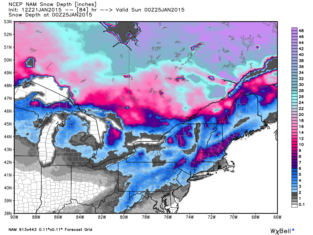
NAM model with deepest snow in interior Southern New England and souther NH, VT, ME

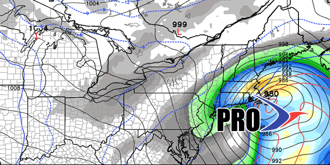
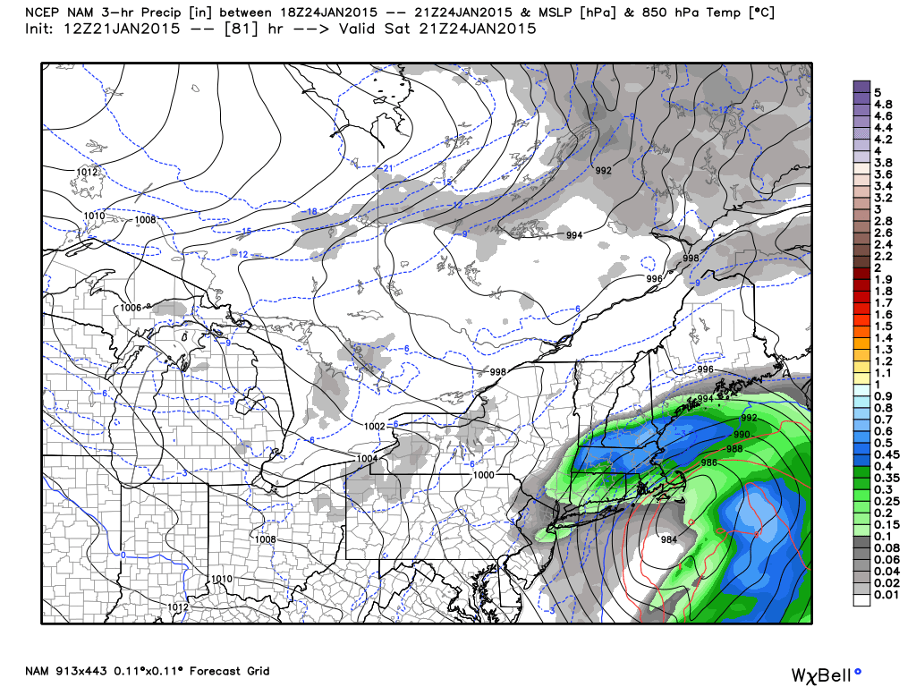
NAM model has a dry slot at the coast as the storm nears Saturday afternoon

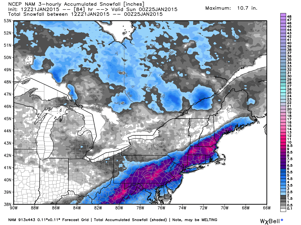
NAM snow accumulation map shows deeper “snow”, but it may count mixed precipitation as snow

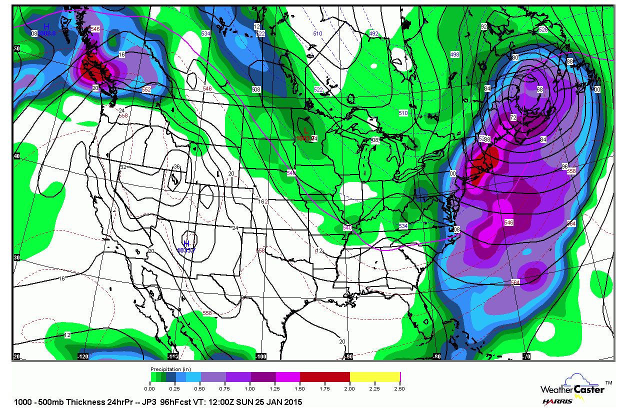
JMA model with a lot of moisture from the storm. Difficult to decipher track/type, but the model has a significant precip. event for SNE

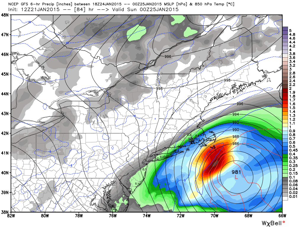
New NOAA GFS model is by far the farthest offshore with this storm. It would be a non-event inland and a light moderate snowstorm near the coast. We think this model is too far south, east and weak.

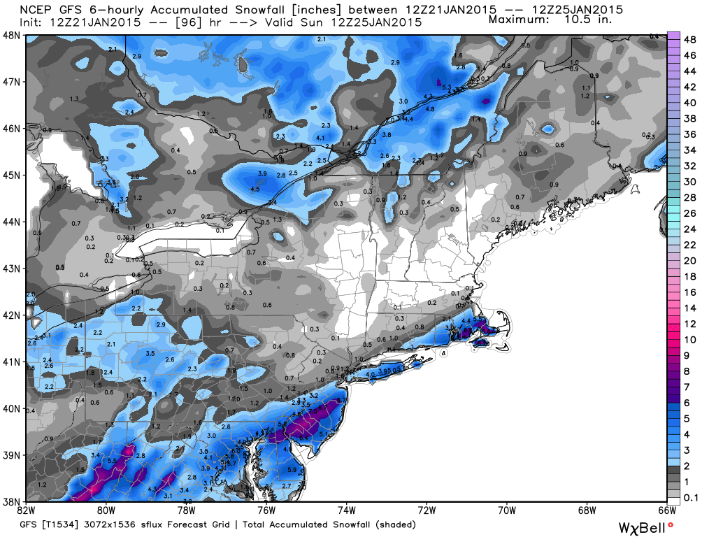
GFS snow forecast

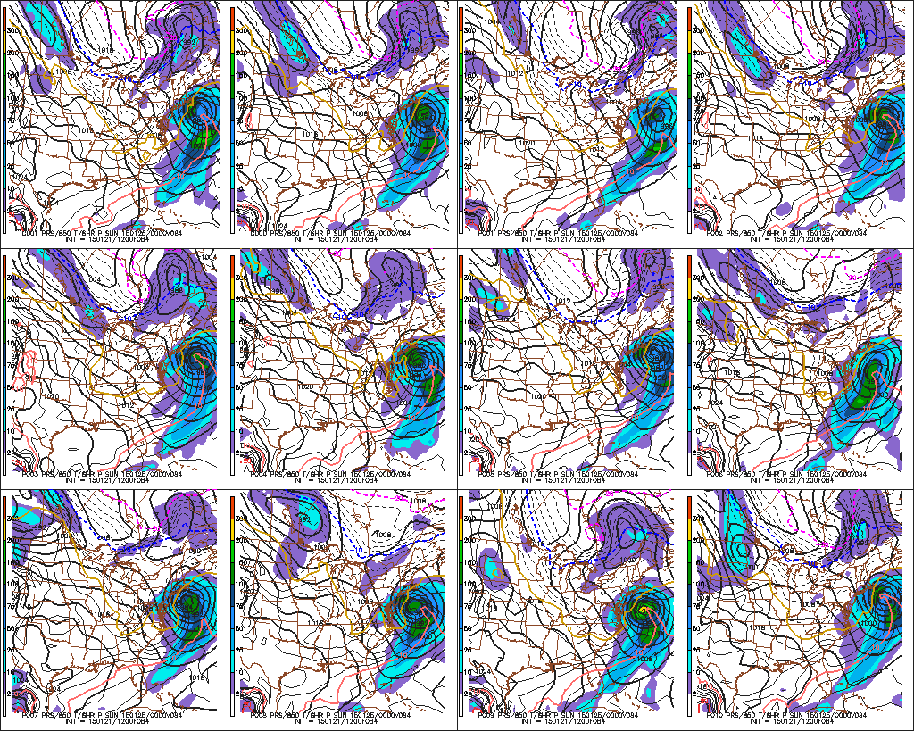
GEFS members with pretty good agreement on some impact this weekend

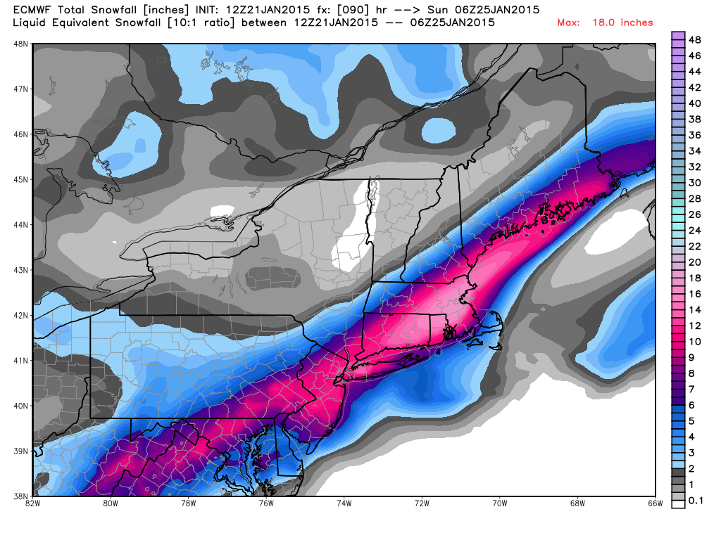
ECMWF snow forecast is bullish on a big snowstorm for most of SNE away from the coast. Notice how it’s a relatively narrow strip of mod/heavy snow

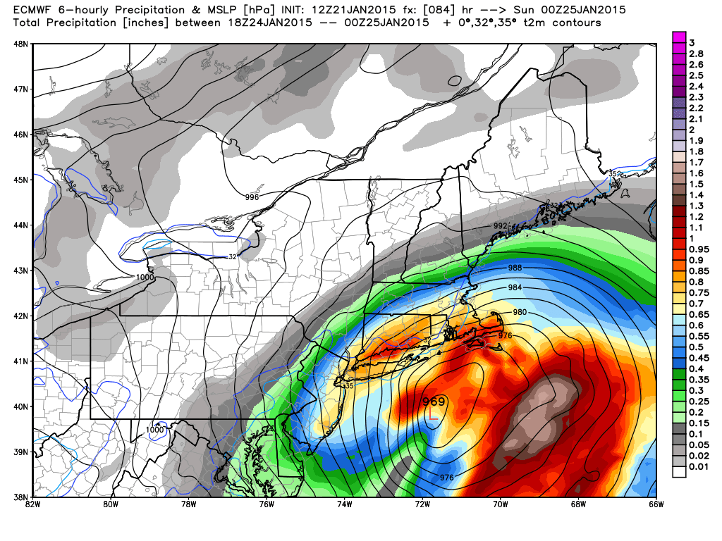
ECMWF has the storm pretty wound up on Saturday afternoon/evening

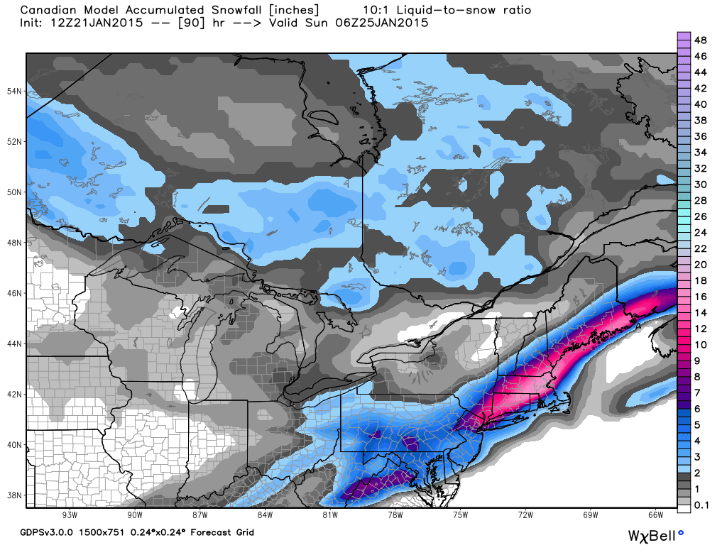
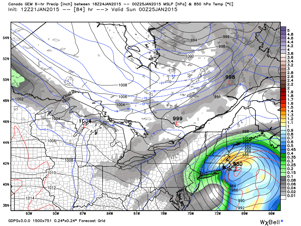
CMC (Canadian) model looks to us like the best solution at this point. A moderate to high impact snowstorm inland, with rain on Cape Cod, and a mix in the I-95 corridor

CMC model is a little to close to ACK (Nantucket) for a big I-95 snowstorm

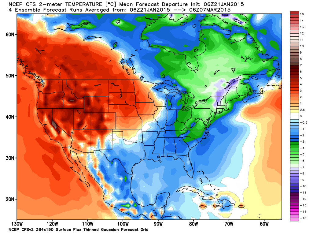
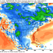
The CFSv2 model has been consistent in a VERY COLD stretch of weather in the next 45 days in the Northeast. If this is accurate, it will be memorable.