Long-Range Forecast – July 24
The pattern in the next two weeks may evolve to something slightly different from we have seen so far this summer, but it is unlikely to bring extreme heat to Southern New England. Next week will start with showers, but should improve by midweek. The air that moves in Tuesday and Wednesday will be relatively dry and comfortable. Highs will be seasonably cool, in the upper 70s to low 80s, and nights will be nice, with lows in the upper 50s to low 60s – something we have enjoyed a lot this summer.
The potential change in the pattern during the first week of August would have the Bermuda high backing in from the east, and a boundary between warm/muggy and cool/dry weather setting up along the Eastern Seaboard. Unfortunately, showers like to form along those boundaries, and if it sets up, we’ll have to deal with occasional rain during that week. It’s certainly not set in stone, but it’s something to keep an eye on in the next week.
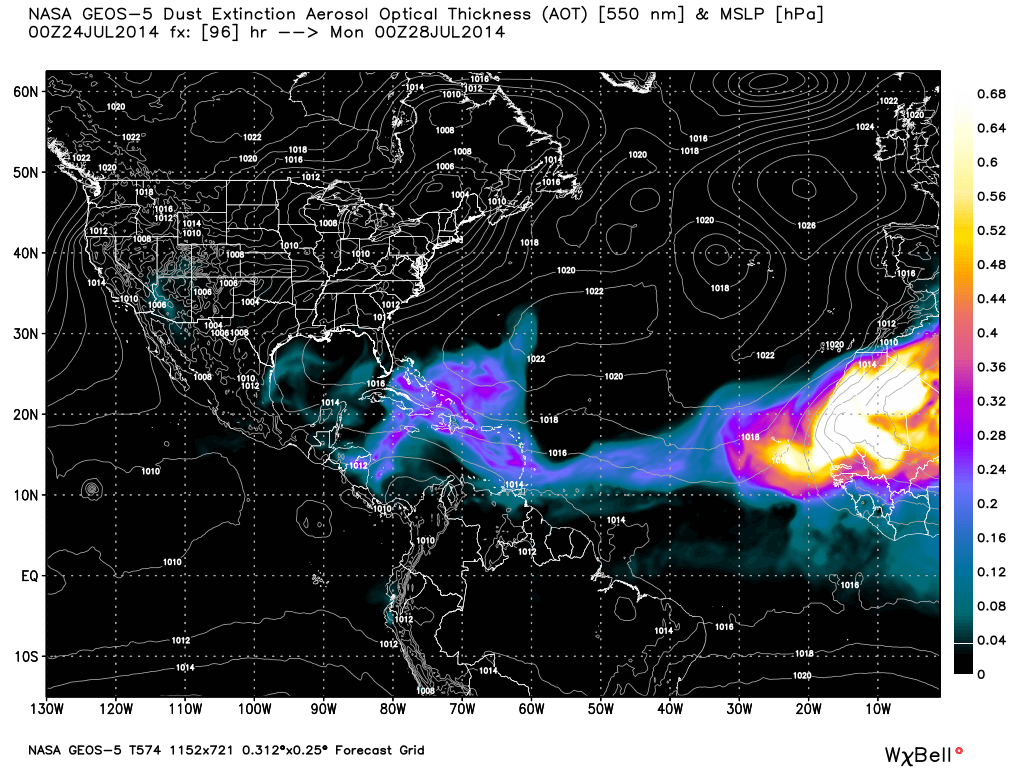
Lots of Saharan dust should limit any tropical development in the next week