Long-Range Forecast – February 23

If you’re a weather buff, remember this month. You may never see another one like it. February 2015 will go into the books as the one of the coldest and snowiest months on record in Southern New England. It looks like it will be the coldest on record in Hartford and Worcester, and second coldest in Providence and Boston. It’s the snowiest February on record in Worcester and Boston, second in Providence, and third in Worcester.

Every day this month will be colder than normal in Providence. In fact, the streak of below normal days dates back to January 26. If you don’t think that is a remarkable stat, I challenge you to start keeping track of the streaks of colder/warmer than normal weather after this one ends. You may not see one longer than this (warm or cold) in your lifetime. There is another cold weather stat or two in the video.

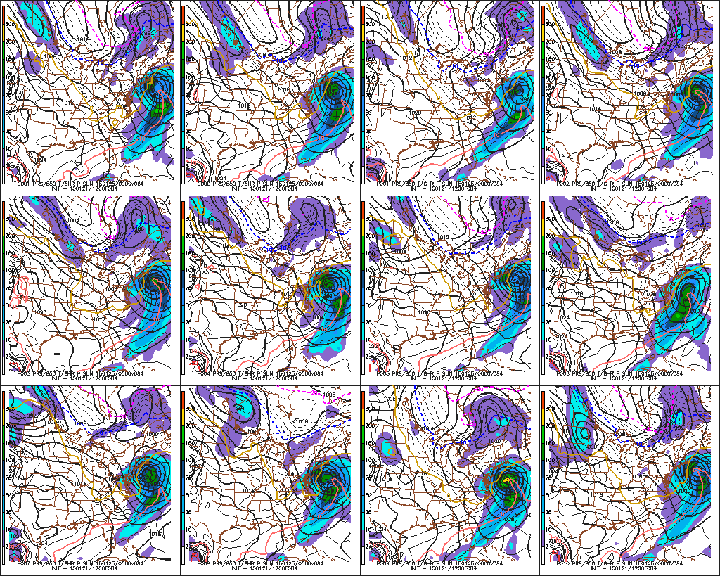
There is a chance of light snow Tuesday night as a system shoots by east of New England. The best chance of picking up a couple of inches is on Cape Cod. On Thursday, there will be a storm moving off the Southeastern United States coast. We’re keeping an eye on it for a slight chance of snow as it has trended north. Right now, odds still favor a miss.

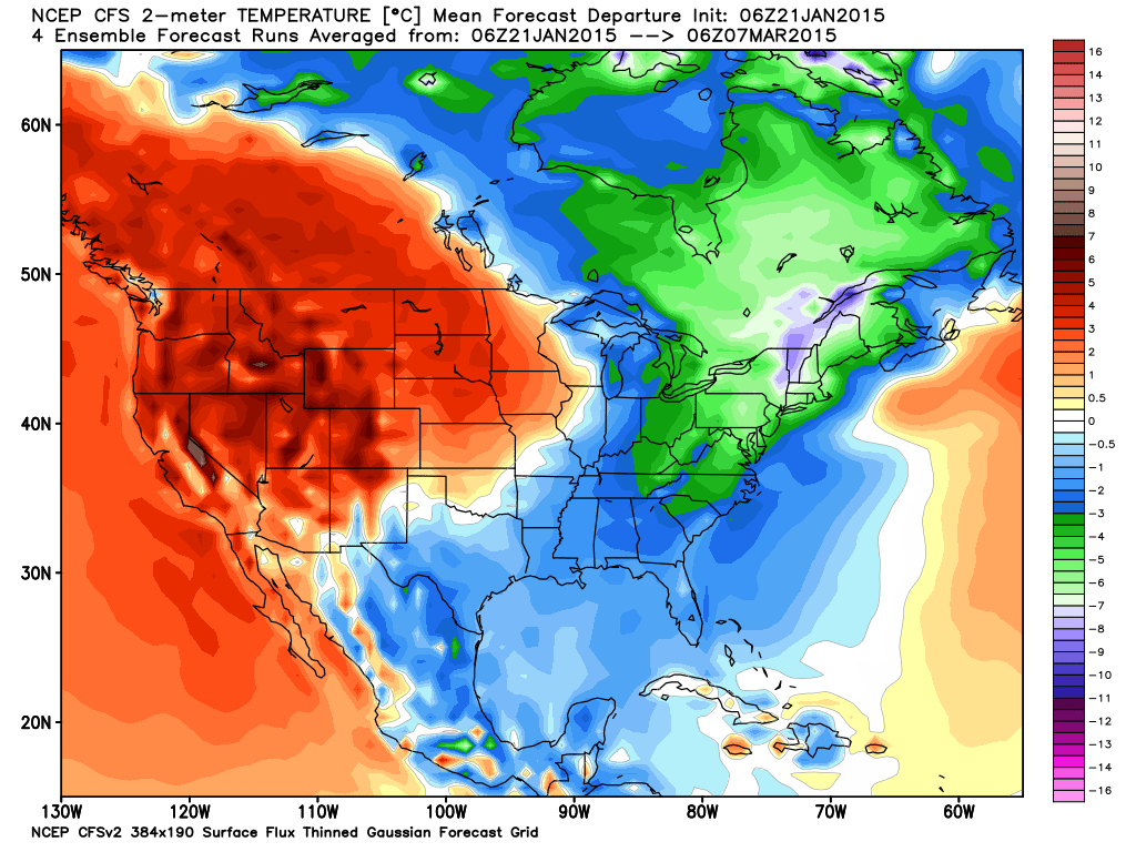
The weekend looks fairly quiet, with a cold end to the month on Saturday. It may reach 40° for the first in forever (Jan 19) on Sunday ahead of the next storm that will likely bring mixed precipitation and rain early next week. After that, there will be more cold/dry weather for a bit. Overall, the pattern looks colder than normal through the first half of March, and probably longer than that. While it will be staying relatively cold, the chill will not be as bad because the normal temperature is steadily rising as we near spring. Two weeks from now, the normal high is 46°. Boston is within shouting distance of its all-time winter snow record, and will get there with just a normal amount of snow from here on out. Odds are, there will be near to above snowfall in the next few weeks, so history could be made in Boston this March.

Long-Range Forecast – February 19

Go big or go home, right? Well, this February is going very big. It will likely be the snowiest on record in all of Southeastern New England. While it will most likely not be the coldest month on record, odds are it will be the second coldest – and we’re not just talking about February. The temperature has not reached 40° since January 19, and there has not been a warmer than normal day since January 25!


The pattern in the next couple of weeks looks very cold, but one day may be the fly in the ointment for keeping some of these streaks going. A storm system arriving late Saturday has the potential to end the below normal streak and possibly drive the temperature above 40° in Providence. At this point, I’m hoping it continues to trend colder and we somehow keep both streaks intact! Go big or go home, right?

The storm will likely bring accumulating snow Saturday evening followed by a wintry mix after midnight into Sunday morning. We’ll cover that in depth on rightweather.com in the next couple of days. It will be followed by (what else?) another Arctic blast early next week. Some models want to bring a storm north from the North Carolina coast to New England in the midweek. That looks plausible to me, and it could be another significant snow event in Southeastern New England. Still a long way out, though…

The trough of cold air in the Eastern United States will persist into March, and you can count on more snow threats through the first week of the month, and probably longer than that. I have heard some “where’s spring?” comments lately. Are you kidding me? It’s still February! In a normal winter that’s a ridiculous thought. In this winter, I would not hold my breath waiting for a warm-up. Cold breeds cold, and with two feet of snow on the ground, this pattern has legs for a while. If anything, count on a late spring in Southern New England…and don’t shoot the messenger!

Long-Range Forecast: February 17

It looks like the cold weather pattern will persist into March in the Northeastern United States. However, Southern New England may be spared the brunt of the stormy weather in the next couple of weeks. After light snow Tuesday morning, there may be occasional flurries and snow showers into the end of the workweek. It should not be a big deal. An elongated storm system moves across the country late in the workweek, and it will arrive in Southern New England late Saturday into Sunday. The models are showing this as a relatively warm system cutting to our north, but we expect it to trend south and bring more snow than rain. It does not look very intense, but any snow at this point is too much for many Southern New Englanders.

Next week’s pattern looks cold and mainly dry early in the week. The European model wants to send a system our way in the midweek, but the GFS is not as robust. The end of next workweek looks dry and cold.

Just a little tidbit…every day since January 26 has been colder than normal in Providence. If the weekend storm stays south, there is a decent chance that the streak lasts through the end of February. It’s already the longest streak of colder or warm weather that I can remember, and I will be digging through the records trying to find a calendar month where every day was warmer or colder than normal.

Long-Range Forecast – February 12

If you’re a winter weather lover, then you best savor this pattern because you may not see another one like for a long time. Boston is well on its way to smashing a record that I thought I would never see broken. 1995-96 is the benchmark for snowfall in Southern New England with 105+” in Boston and Providence. Boston is closing in on 80″ and with storms lining up, they may break the record before February 20th! Providence is not even halfway to the record, but the second highest season snow total on record is 30.5″ less than the epic 106.1″ in 1995-96. Providence may make a strong run at the second snowiest winter since 1905. That, too, could happen before February ends!

We are, of course, looking at a potentially big storm this weekend. It will be followed by a bitter blast early next week, and then a southern streamer that could bring another substantial snow Tuesday night through Wednesday. That storm is trending south, but still comes close enough for mixing issues near the south. If it continues trending south, it may become more of a glancing blow. That cannot be ruled out, at this point.

It will get cold and dry again late next week. The models are hinting at another storm sometime around February 22-24, and when looking at the longer range, the hits keep coming right through the end of February into early March. The temperature will be running extremely cold for February, and this should be a top-5 coldest February on record in Southeastern New England.

What more is there to say?

Long-Range Forecast – February 9

It is hard to keep track of all the snowstorms we have had in the past few weeks. This is one of the most incredible stretches of winter weather in Southern New England’s recorded history. It is by far the snowiest 30-day stretch in Boston, and it will likely be the snowiest February on record in Boston. It has not been <em>as </em>snowy in Providence, but it still ranks among the all-time great runs for snow-lovers, and it is by no means over yet.

We are looking at snow potential for Thursday night and/or Saturday night. Further down the road, it looks like the southern branch of the jet stream could get active, and if the storm track stays to our south, some big storms are possible before the end of February. As mentioned in the video, there are <em>three</em> major East Coast storms between February 20 and March 4 on the European monthly computer model which came out this evening. While it’s tough to accurately predict the details of such events so far into the future, it certainly speaks to the high-potential pattern that will stay in place.

Aside from the snow, this is shaping up to be among the top-5 coldest Februarys on record in the Providence area. To me, that’s even more remarkable than the snow…I think. It doesn’t really matter. Either way, this has turned into a winter to remember after an extremely slow start.

Long-Range Forecast – February 5

If you have been following the Pro Live Blogs this week, then you know we’re watching the potential for a snowy stretch from Saturday evening through Monday night. The jury is still out on how snowy it will be, and it’s possible a lot of the action will be in Northern New England. We’ll continue to update the finer points of that forecast in daily Live Blogs.

As for the overall weather pattern through mid-February….you can expect plenty of cold weather. In fact, this month has the potential to be among the five or ten coldest Februarys on record in Southern New England. It does not look as stormy after a clipper comes through next Thursday or so. There could be a mainly dry stretch from the end of next week through most of the following week. It will, however, stay quite cold, and relative to normal, the coldest may be yet to come.

Long-Range Forecast – February 2

We are in the midst of a very snowy stretch, and the potential exists for even more in the next couple of weeks. The overall pattern begs for storms along the Eastern Seaboard through mid-February. There will be a wealth of cold air around, so more snow is most likely in the offing.

Exact timing and storm tracks are unclear, but there will be several shots for snow through Valentine’s Day. In the near-term, we’re focusing on Thursday and early next week for snow chances. After that, it looks like there could be something late next week as a storm sits off the SE US coast. And, just for good measure, something is possible near Valentine’s Day, too!

There will be bitter blasts after the storms, and single digits nighttime readings may become commonplace with such a deep snowpack.

Long-Range Forecast – January 29

Hopefully, if you were following the Long-Range Forecast for the past couple of weeks, this cold and active weather pattern did not come out of nowhere for you. It looks like it will be staying cold, and somewhat active, into mid-February.

There is the dynamic system on Friday that will likely blow up just a little too far east to spare Southern New England a mini-blizzard Friday night into Saturday. There could be some icy roads and the wind will be howling as the temperature plummets. After a very cold weekend, a southern streamer makes a run at us on Monday. Indications are it will come close enough for some snow, but it’s still unclear if it’s an inch or two, or 5-10″. If this storm travels far enough north, significant accumulating snow is likely. It’ll be a fast mover, but it will run into very cold air, and the snow would pile up. We’ll keep you posted in the next few days.

Further down the road, there could be another system late next workweek, and then again in the early to middle part of the following week. Between any storms, it will be plenty cold. The month of February is shaping up to be colder than normal, and after a very cold January, the winter as a whole may be below normal. Who’d thunk it after the very mild December. It’s also likely to feature above normal snow, something that did not look promising when looking at just the totals to date a couple of weeks ago.

Long-Range Forecast – January 22

We see no reason to change our view that there will be many chances for snow in the next two to three weeks in Southeastern New England. It remains to be seen if it will become the kind of hyper-active pattern that we’ve seen in February and/or March for the past couple of years, but it looks a lot more like winter than the pattern we saw for December and part of January. Not every storm (see Saturday) is going to deliver on its full potential for snow, but, for snow-lovers (of which there are many and they tend to make the most noise) at least we are talking about the possibility of snow where that was not even discussed in most of December and early January.

The pattern has a high potential for storminess, but it is more of a lock for cold weather. There is not much doubt that there will be ample cold air around, and possibly some extremely frigid outbreaks in the next two to three weeks. That’s not great news for our heating bills, but, at least the cost of oil is lower than in many recent winters.

Specifically, we’re watching a storm threat early next week. It would be all snow, but it’s unclear if the system will pass to far south and east to bring accumulating snow or if there will be several inches of fluff. The timing is Monday into Monday night. There will probably be a dry and very cold midweek. Further down the road, the northern branch of the jet stream will probably be active, and if some of the energy phases with the southern branch, then potentially big East Coast storms could be on the table. As stated earlier, it’s not a lock, but it’s not like it was earlier in the winter when we were saying there’s no chance of it happening.

A long video below with lots of interesting graphics!

Computer Model Trends: Weekend Storm Likely

We have been banging the “cold and potentially active” drum for a while regarding the weather for late January and early February. There is little doubt that a cold pattern is developing for most of the country, and it seems that there will be a storm that hits instead of nearly missing this weekend. It may not satisfy the snow-lovers in Southeastern New England as the setup and track suggests some mixing from the coast to I-95, but inland stands to get hit pretty hard based on the latest guidance.

There are a few important concerns about the storm. First, there is not a lot of very cold air to the north of the storm, and if it tracks close to Nantucket, there will likely be enough warm air drawn into the storm for a mix and dry slot to reach the coast and probably I-95. Conversely, the lack of cold air to the north makes a weaker baroclinic zone in the zone. The upshot of this is you don’t have a stark contrast between the warm/cold air, and the moderate to heavy precipitation may not extend as far from the center as it can with late-January storms in the Atlantic Ocean.

At this point, we’re expecting a relatively quick-hitting significant storm on Saturday. It will probably not last more than 12 hours, but the precipitation may be heavy at times Saturday afternoon and early evening. The best chance of several inches of snow is from I-95 to Worcester County, with some snow, a wintry mix, and maybe even rain southeast of I-95. It’s too early to say that there will not be 6″+ of snow from Providence to Boston, but the latest information suggests that axis could be a little farther inland.

NAM model with deepest snow in interior Southern New England and souther NH, VT, ME

NAM model with deepest snow in interior Southern New England and souther NH, VT, ME

NAM model has a dry slot at the coast as the storm nears Saturday afternoon

NAM model has a dry slot at the coast as the storm nears Saturday afternoon

NAM snow accumulation map shows deeper "snow", but it may count mixed precipitation as snow

NAM snow accumulation map shows deeper “snow”, but it may count mixed precipitation as snow

JMA model with a lot of moisture from the storm. Difficult to decipher track/type, but the model has a significant precip. event for SNE

JMA model with a lot of moisture from the storm. Difficult to decipher track/type, but the model has a significant precip. event for SNE

New NOAA GFS model is by far the farthest offshore with this storm. It would be a non-event inland and a light moderate snowstorm near the coast. We think this model is too far south, east and weak.

New NOAA GFS model is by far the farthest offshore with this storm. It would be a non-event inland and a light moderate snowstorm near the coast. We think this model is too far south, east and weak.

GFS snow forecast

GFS snow forecast

GEFS members with pretty good agreement on some impact this weekend

GEFS members with pretty good agreement on some impact this weekend

ECMWF snow forecast is bullish on a big snowstorm for most of SNE away from the coast. Notice how it's a relatively narrow strip of mod/heavy snow

ECMWF snow forecast is bullish on a big snowstorm for most of SNE away from the coast. Notice how it’s a relatively narrow strip of mod/heavy snow

ECMWF has the storm pretty wound up on Saturday afternoon/evening

ECMWF has the storm pretty wound up on Saturday afternoon/evening

CMC (Canadian) model looks to us like the best solution at this point. A moderate to high impact snowstorm inland, with rain on Cape Cod, and a mix in the I-95 corridor

CMC (Canadian) model looks to us like the best solution at this point. A moderate to high impact snowstorm inland, with rain on Cape Cod, and a mix in the I-95 corridor

CMC model is a little to close to ACK (Nantucket) for a big I-95 snowstorm

CMC model is a little to close to ACK (Nantucket) for a big I-95 snowstorm

The CFSv2 model has been consistent in a VERY COLD stretch of weather in the next 45 days in the Northeast. If this is accurate, it will be memorable.

The CFSv2 model has been consistent in a VERY COLD stretch of weather in the next 45 days in the Northeast. If this is accurate, it will be memorable.