Long-Range Forecast – January 1
2014 is in the books as 0.7 degrees cooler than normal in the Providence area. The first few days of 2015 will follow suit with colder than normal weather into the weekend, but a storm arriving Saturday night will be mainly rain with a surge of milder air likely on Sunday. The warmth will not stay for long, and by Monday the highs will be back to the upper 30s – not far from normal. It will be seasonably cold with the chance of light snow or flurries in the midweek as an Alberta Clipper passes by. The best chance of snow is Tuesday night into early Wednesday.
After the Clipper departs, there will be an Arctic blast that brings the coldest weather of the season so far, and possibly the coldest we’ll see all winter. If the full brunt of the Arctic air hits Southern New England, the temperature may nosedive to zero in some spots Thursday or Friday morning. Highs may not make it out of the teens. It will be dry into next weekend.
Overall, January looks like a chilly and active month of weather. It may not be as cold after January 10, but the storm track looks pretty active, so snow chances exist through mid-month. We’re still somewhat concerned about a dry/cold to wet/mild pattern like we’ll see with this weekend’s storm, but the overall storm track looks a little further south (colder) after the big Arctic outbreak at the end of next week.
- Temperature: Below normal next two weeks
- Precipitation: Near normal next two weeks
- Snow: Below normal next two weeks

The temperature spikes with the weekend storm, but it’s back to the ice box next week

The EPS ensembles do not have a lot of snow in the next ten days. Notice how there is pretty good agreement on a minor system in the middle of next week

EPS agreement on big cold shot mid to late next week

Days 10-15 look a lot milder on the EPS. Not sure if it will be extremely mild, and there should be a fairly active storm track in the middle of the month

GFS also showing a slight warm-up in days 10-15

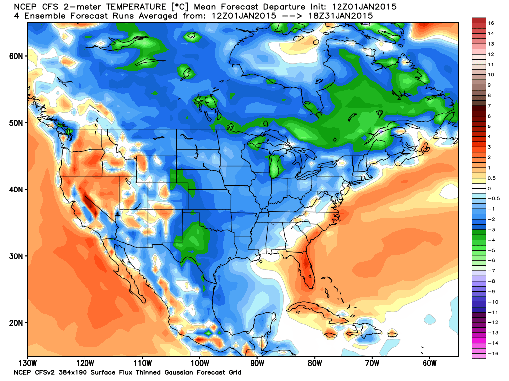
CFS v2 has a cool to cold January for most of the country

CFS v2 is also stormy with above normal precipitation in January


Leave a Reply
Want to join the discussion?Feel free to contribute!