
Significant Storm Likely Next Week
A significant long-duration storm appears likely for New England in the middle to end of next workweek. The storm will move from the Great Lakes to the Southern New England coast and intensify on Tuesday into Wednesday. The storm will become cut-off from the jet stream, and will likely not move much through the end of next workweek.
While the exact track of the storm is questionable, there is the potential for several inches of rain in the hardest hit areas. At this point, it seems that Eastern New England will bear the brunt of the storm with the heaviest rain, strongest winds, and possible coastal flooding due to a persistent northeast wind direction for several days.
Even though the event is still several days away, all reliable computer models are predicting that a storm will form off the New England coast and remain nearly stationary for at least a couple of days. See the graphics below for more explanation on the storm’s potential impacts.
-

- Canadian operational model has several inches of rain in Southern New England next week

-

- ECWMF operational run brings the strongest wind gusts to Northern New England near the end of next workweek. It’s unclear exactly where the storm will be, but this gives you an idea of the wind potential.

-

- European ensemble members indicate a very high likelihood of at least 1″ of rain by the end of next workweek

-

- European ensemble members also predicting a better than 50% chance of 2″ of rain for Eastern New England next week

-

- GFS Ensemble mean has around 2″ of rain for most of Southern New England

-

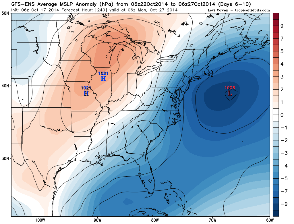
- GFS Ensemble mean MSLP anomaly is very impressive for a storm that is still several days away. This indicates a high likelihood that this storm will form.


Leave a Reply
Want to join the discussion?Feel free to contribute!